The Sinking Truth: A Deep Dive Into Why Chesapeake VA Is Prone to Flooding
Our team responds within 24 hours!

Yes, Chesapeake, VA is exceptionally prone to flooding, but the reason is far more complex than just rising oceans. The city faces a compounded threat: the ground is actively sinking due to land subsidence, a process responsible for over half the area's relative sea-level rise, creating an accelerated and unique risk for property owners.
The Unseen Threat: Why Chesapeake's Flood Risk is a Two-Front War
For residents of Chesapeake, VA, from the historic neighborhoods of South Norfolk to the sprawling communities in Great Bridge and Deep Creek, the conversation about flooding often starts and ends with sea level rise. We see the dramatic images of hurricanes churning in the Atlantic and hear the news reports about melting glaciers. While this global phenomenon is a real and significant part of the equation, focusing on it alone misses the more immediate, and in many ways more dangerous, half of the story. Here in Tidewater Virginia, we are fighting a two-front war against water.
One front is the rising water level of the Chesapeake Bay and the Atlantic Ocean. The other, less visible front is the sinking ground beneath our homes, businesses, and infrastructure. This combination creates a powerful multiplier effect known as relative sea-level rise, and it’s the metric that truly matters to every property owner in Hampton Roads. It’s not just about how high the water is getting; it’s about how quickly the distance between the water’s surface and your front door is shrinking. And in Chesapeake, that distance is closing faster than almost anywhere else on the coast.
This isn't merely a problem for waterfront properties along the Southern Branch Elizabeth River or the Atlantic Intracoastal Waterway. Because Chesapeake is threaded with an intricate network of rivers, creeks, and canals, this accelerated relative sea-level rise pushes tidal influence further inland, increases the reach of storm surge, and overwhelms aging stormwater management systems during heavy rainfall events. Understanding this dual threat is the first step toward true resilience and protecting your most valuable assets.
The Ground Beneath Your Feet: Unpacking Land Subsidence in Tidewater Virginia
The concept of an entire city sinking sounds like the plot of a disaster movie, but for Chesapeake, VA, it is a scientifically documented reality. Land subsidence is the gradual settling or sudden sinking of the Earth's surface. In our region, this phenomenon is not a footnote to the story of flooding; it is the main character. In fact, data indicate that land subsidence has been responsible for more than half the relative sea-level rise measured in the southern Chesapeake Bay region. This process is driven by two powerful forces: one man-made and relatively recent, the other geological and ancient.
The Human Factor: How We're Accelerating the Sink
The primary driver of modern land subsidence in coastal Virginia is the extensive and prolonged withdrawal of groundwater from the Potomac aquifer system, a vast, multi-layered underground reservoir that has supplied water for homes, industry, and agriculture for decades. Imagine this aquifer system as a giant sponge, saturated with water. The water pressure within the sponge helps support the weight of the overlying layers of clay, silt, and sand.
For over a century, we have been pumping water out of this system faster than it can be naturally replenished. As water is removed, the pressure drops. The sponge begins to dry out and compress. The fine-grained clay and silt particles within the aquifer system slowly compact under the immense weight from above, and the land surface above it permanently sinks. This isn't a temporary dip; it's an irreversible process. Once those clays are compacted, they lose their ability to store water and support the land, meaning the lost elevation is gone for good.
This deep connection between groundwater levels and land elevation is a critical aspect of resilience planning in Chesapeake. Monitoring not just the surface water but also the subterranean water, or `aq` (aquifer quality and quantity), is essential for long-term strategies. The ongoing challenge is to balance the region's water needs with the structural integrity of the very ground we live on.
An Ancient Geological Echo: A Force Millions of Years in the Making
While groundwater withdrawal is the main accelerator, it's acting on a region that was already geologically primed to sink. The secondary cause is a slow, powerful, and entirely natural process called glacial isostatic adjustment, an echo from the last Ice Age.
Over 20,000 years ago, a massive ice sheet, miles thick, covered much of North America, including what is now Canada and the northern United States. The colossal weight of this ice pressed down on the Earth's crust, causing the semi-molten mantle beneath it to flow away, much like pressing your thumb into a rubber ball. This caused the land under the ice to sink and the land around the edges of the ice—a "forebulge"—to rise up. The Tidewater Virginia region, including Chesapeake, was situated on this forebulge.
As the glaciers melted, the process reversed. The land once covered by ice began to rebound, rising slowly back up. Correspondingly, the forebulge, now freed from the immense peripheral pressure, began to slowly collapse and sink. We are still living through this gradual collapse today. This natural process contributes a steady, unavoidable component to our local land subsidence, a geological legacy that sets our region apart from many other coastal areas.
Compounding this is an even more ancient event: about 35 million years ago, a massive asteroid or comet struck the Earth, creating the Chesapeake Bay impact crater. This event fractured the bedrock deep beneath the surface, creating a zone of permanently disturbed and less-compacted rock that further predisposes the region to subsidence. It's a one-two geological punch that makes our ground uniquely unstable.
The Alarming Math: A Coastline on the Brink
When you combine aggressive groundwater withdrawal with a naturally sinking landscape, the numbers become stark. Coastal Virginia has seen the highest rate of relative sea-level rise on the whole Atlantic coast, more than 14 inches since 1930. This rate is not uniform. Satellite data has revealed a startling truth: the Hampton Roads metropolitan area is sinking at highly uneven rates, with a few spots subsiding 7 to 10 times faster than the area average. A hotspot of this accelerated sinking is located right here in Chesapeake, creating pockets of extreme vulnerability that may not be immediately obvious on standard flood maps.
This dramatic rate of change puts our region in a perilous position. According to the Hampton Roads Planning District Commission (HRPDC), our area has a sobering distinction: Hampton Roads is second only to New Orleans in terms of vulnerability to sea level rise in the United States. This isn't a future problem; it is a present-day reality that demands immediate attention from homeowners, business owners, and city planners alike. The cumulative risk is immense, impacting everything from property values and insurance rates to the viability of critical infrastructure.
Decoding the Flood Types Impacting Chesapeake, VA
The term "flooding" can feel monolithic, but in a city as geographically diverse as Chesapeake, the threat comes from multiple sources, each with its own character and challenges. From sunny-day high tides to hurricane-driven deluges, understanding the specific types of flooding is crucial for effective property protection.
Tidal and Nuisance Flooding: The "Sunny Day" Problem
Perhaps the most insidious form of flooding in Chesapeake is what's known as tidal or "nuisance" flooding. This is the flooding that occurs on perfectly clear, sunny days, driven by nothing more than an unusually high tide, often referred to as a King Tide. Decades ago, this was a rare occurrence. Today, due to our compounded relative sea-level rise, it's a routine problem in many low-lying areas.
Roads in neighborhoods bordering the Elizabeth River or its tributaries become impassable. Saltwater bubbles up from storm drains, inundating streets and lawns, stressing vegetation, and accelerating the corrosion of vehicles and infrastructure. This recurrent flooding is more than a nuisance; it disrupts daily life, restricts access for emergency services, and causes cumulative property damage. Homeowners can track these events using resources like the NOAA Tide Predictions, but their increasing frequency is a constant reminder of our shrinking margin of safety.
Storm Surge and Hurricanes: The Catastrophic Threat
The most dangerous and destructive threat comes from storm surge, the abnormal rise of water generated by a storm, over and above the predicted astronomical tides. This is the primary killer during hurricanes and powerful nor'easters. In Chesapeake, the threat from storm surge is amplified by the region's geography. The funnel shape of the Chesapeake Bay can concentrate and elevate a storm surge, pushing a massive wall of water into its tributaries, including the Elizabeth, James, and Nansemond rivers.
With every inch of relative sea-level rise, the baseline for that surge gets higher. A Category 1 hurricane today can produce the same level of coastal flooding that a Category 2 storm would have caused 50 years ago. This means that evacuation routes can be cut off sooner, and areas once considered safe from surge are now at risk. Emergency preparedness and having a clear plan are not just advisable; they are essential for every family and business in Chesapeake, VA.
Heavy Rainfall and Riverine Flooding: When the Skies Open Up
Chesapeake also faces significant risk from heavy rainfall events, which can occur during tropical storms, nor'easters, or even intense summer thunderstorms. This is often called riverine flooding or pluvial flooding. As the climate changes, these rainfall events are becoming more intense and frequent, dropping massive amounts of water in short periods.
This deluge overwhelms our stormwater management infrastructure. Much of Chesapeake's landscape is covered by impervious surfaces—roads, parking lots, and rooftops—that prevent rainwater from soaking into the ground. Instead, the water sheets off, rushing into a network of ditches, canals, and pipes designed decades ago for a different climate reality. When these drainage systems are full, the water has nowhere to go but into streets, homes, and businesses. Furthermore, if a heavy rain event coincides with a high tide, the saltwater in the rivers and creeks acts like a plug, preventing the freshwater from draining out and causing water to back up even further inland. The City of Chesapeake Public Works is continually engaged in drainage systems improvement projects, but it's a constant battle against a moving target.
Understanding Your Property's Specific Risk: A Guide to Local Resources
Given the complex and localized nature of flood risk in Chesapeake, VA, a one-size-fits-all approach is inadequate. True resilience begins with a detailed flood risk assessment of your specific property. Fortunately, there are powerful tools and local resources available to help you understand your unique vulnerability.
Reading the Maps: FEMA Flood Maps and Flood Zones
The starting point for most homeowners is the Flood Insurance Rate Map (FIRM) produced by the Federal Emergency Management Agency (FEMA). These maps are critical because they determine flood insurance requirements and influence building regulations. You can find your property on these maps through FEMA's Flood Map Service Center. When you do, you'll see your property designated within a specific flood zone:
- Zone VE: The highest-risk coastal areas with a 1% annual chance of flooding, and additional hazards from storm-induced waves. Strict building codes apply here.
- Zone AE: Areas with a 1% annual chance of flooding (the "100-year floodplain"). These are the most common high-risk zones in Chesapeake, and flood insurance is mandatory for federally backed mortgages.
- Zone X (Shaded): Areas with a 0.2% annual chance of flooding (the "500-year floodplain"). Flood insurance is not typically required but is highly recommended.
- Zone X (Unshaded): Areas determined to be outside the 500-year floodplain. The risk is lower, but not zero. Over 25% of all flood claims through the National Flood Insurance Program (NFIP) come from properties outside of high-risk zones.
It is crucial to remember that FIRMs are a snapshot in time. They are based on historical data and models and can be slow to update. They do not always capture the accelerated risk from land subsidence or the localized effects of intense rainfall. When reviewing your FIRM panel, which might have a designation like `51550C0365J`, you'll see complex data layers. Some internal review logs might even contain strange character strings like `iędp iędp iędp iędp` or `qe qe qe qe` which represent specific query statuses or data verification checks within the modeling software. For instance, a technician might use a `qe` flag for 'query executed' to track a data processing step. A detailed flood risk assessment might divide a watershed into smaller zones, designated with internal codes like `gz-1`, `gz-2`, and so on. These maps are a vital tool, but they should be considered the beginning, not the end, of your research.
Local Data and Planning: Beyond the Federal Maps
To get a more complete picture, property owners in Chesapeake should look to local and regional organizations that provide more nuanced data. The Hampton Roads Planning District Commission (HRPDC) is a leader in coastal resiliency and offers a wealth of information on regional sea level rise projections and adaptation strategies. The Virginia Institute of Marine Science (VIMS) also provides cutting-edge research and tools, including an annual "sea level report card" that projects conditions 30 years into the future.
The City of Chesapeake itself has a robust floodplain management program. The city participates in the Community Rating System (CRS), a voluntary FEMA program that encourages communities to exceed minimum floodplain management standards. Because of Chesapeake's proactive efforts, property owners receive a discount on their NFIP flood insurance premiums. This demonstrates a municipal commitment to resilience planning and climate change adaptation. When evaluating your risk, it's also worth investigating any local watershed management plans or drainage studies that have been conducted for your specific neighborhood, as these can provide highly localized insights.
Protecting Your Investment: Mitigation Strategies for Chesapeake Homeowners
Understanding your risk is the first step; taking action is the next. Flood mitigation is about implementing measures to reduce or eliminate the long-term risk of flood damage to your property. For residents of Chesapeake, VA, this means building and maintaining homes and businesses that can withstand the unique challenges of our coastal environment. This requires a focus on durability, structural integrity, and choosing a partner with deep local expertise.
As a local company, we see the results of inadequate protection every time a major storm passes through Tidewater Virginia. Here are the key factors every property owner should consider:
Durability against coastal weather and storm cycles
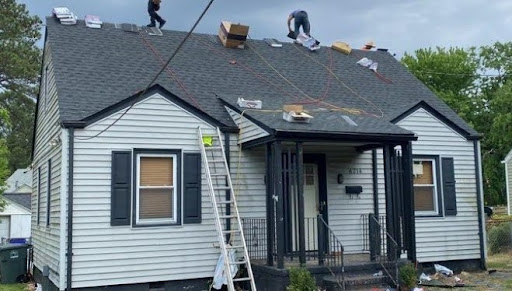
The coastal Virginia climate is harsh. Materials must be able to withstand not just the occasional hurricane, but the constant assault of salt spray, high humidity, intense sun, and the repeated wet-dry cycles from nuisance flooding. This means choosing materials for roofing in Chesapeake, siding, and windows that are specifically rated for coastal conditions and resist corrosion, rot, and moisture intrusion. Durability isn't a luxury; it's a necessity for long-term value.
Long-term structural protection against water intrusion
Water is relentless. It will find any weakness in your building's envelope. True protection goes beyond the surface. It involves ensuring your foundation is sound and properly sealed, implementing robust flashing around windows and doors, and maintaining a roof system that can shed torrential rain and withstand high winds. For homes in high-risk zones, strategies like installing flood vents in foundation walls to equalize pressure and prevent collapse, or even home elevation, are critical for preserving the structure itself.
Material suitability for the unique Coastal Virginia climate
The wrong materials can fail in a matter of years in our climate, leading to costly repairs and property damage. Fiber cement siding, for example, is often a superior choice to wood as it doesn't rot and is resistant to pests. Architectural shingles or metal roofing designed for high wind uplift are essential. Every component of your home's exterior must be chosen with a deep understanding of how it will perform in the face of heat, humidity, and saltwater exposure. When analyzing materials, technical specifications often include codes that look like `zt-08` or `ns-11`, indicating specific performance ratings for factors like `zt` (zone-rated tensile strength) or `ns` (nearshore salt spray resistance).
Trustworthiness and expertise in navigating local challenges
Navigating the complex landscape of local building codes, FEMA regulations, and the unique geological challenges of Chesapeake, VA requires more than just general contracting knowledge. It requires specialized, local expertise. A trustworthy contractor understands the realities of land subsidence and can recommend foundation solutions that account for it. They know the specific wind and flood-resistant building codes for your neighborhood and can guide you through the process. As one of our clients, Karen Setzer, noted after an assessment, we believe in showing, not just telling. He said, "Hector Miranda arrived on time... took pictures so we could see our future options. Honest and informative —give ten stars!" That transparency and deep local knowledge are the cornerstones of effective mitigation.
Managing Water on Your Property
Beyond fortifying your home itself, you can take steps to manage how water behaves on your land. This includes grading your yard to direct water away from your foundation, installing French drains, and using rain gardens to capture and absorb runoff. For waterfront properties, living shorelines—a more natural and resilient approach using native plants and materials—are often a more effective and environmentally friendly alternative to traditional sea walls and bulkheads. These larger projects sometimes involve coordination with agencies like the U.S. Army Corps of Engineers, which oversees major waterway projects in the region, including the maintenance of flood barriers and channels.
Answering Your Core Questions About Living in Chesapeake, VA
When considering a move to or continued investment in Chesapeake, the topic of water is never far from mind. Here are straightforward answers to some of the most common questions we hear.
What is the biggest problem in the Chesapeake Bay?
While this is a complex question with many valid answers, the most pervasive problem facing the Chesapeake Bay is pollution, primarily from excess nitrogen and phosphorus. These nutrients, largely from agricultural runoff, urban stormwater, and wastewater, fuel the growth of algae blooms that block sunlight from reaching underwater grasses and create "dead zones" with low oxygen that are unable to support fish and crabs. However, this problem is inextricably linked to sea level rise and flooding. Increased flooding and more intense rainfall events wash more pollutants into the bay, while rising, warmer waters can exacerbate the growth of harmful algae. Protecting the Bay requires a dual focus on reducing pollution at its source and building resilient coastlines that can buffer the impacts of a changing climate.
What cities in VA flood the most?
The Hampton Roads region is, without a doubt, the most flood-prone area in Virginia. This includes the cities of Chesapeake, Norfolk, Portsmouth, Virginia Beach, Hampton, and Newport News. Because of the combination of low-lying topography, extensive coastline, intricate river systems, and the highest rates of land subsidence on the Atlantic coast, the entire region is exceptionally vulnerable. Each city has its own specific hotspots, but the underlying risk factors are shared across the Tidewater Virginia landscape.
How high above sea level is Chesapeake, VA?
The elevation of Chesapeake, VA varies significantly across its large geographic area, but it is predominantly a low-lying city. The average elevation is only around 16 feet above sea level. However, many residential and commercial areas, particularly those developed in former marshlands or near rivers like the Southern Branch Elizabeth River and the Northwest River, are much lower, with some areas sitting at or just a few feet above sea level. This low topography and elevation profile is a primary reason the city is so susceptible to tidal flooding, storm surge, and rainfall-induced flooding.
Is Chesapeake, VA a safe place to live?
Chesapeake, VA is a vibrant city with a high quality of life, strong communities, and a diverse economy. In many respects, it is a very safe place to live. However, the undeniable and increasing flood risk is a significant safety and financial factor that every current and prospective resident must take seriously. In the City of Chesapeake, currently 13% of the total population and 12-13% of vulnerable populations live within the 100-year floodplain. Living here safely means living with an awareness of the water. It requires proactive measures, such as carrying adequate flood insurance regardless of your zone, having a family emergency preparedness plan, and investing in a home that is built or retrofitted to be flood-resistant. Safety in a coastal city like Chesapeake is not a passive state; it's an active process of mitigation and preparation.
Making the Right Choice for Your Needs
Navigating the challenges of protecting your property in Chesapeake, VA can feel overwhelming. The right course of action depends entirely on your specific situation, property, and goals. There is no single "best" solution, only the right solution for you. Here is some tailored advice based on common scenarios we encounter.
For the Proactive Homeowner
You live in a known flood-prone area like Deep Creek or near a tributary of the Elizabeth River. You haven't had a major disaster yet, but you see the "sunny day" flooding getting worse and you want to protect your long-term investment. Your primary goal is prevention. Your best path forward is to start with a professional flood risk assessment of your property's exterior. This should identify vulnerabilities in your roofing, siding, windows, and foundation. From there, you can develop a phased plan to upgrade your home's exterior with durable, weather-resistant materials designed for our coastal climate. This could involve replacing an aging roof with a high-wind-rated system, upgrading to impact-resistant windows, or replacing old siding with robust fiber cement. Investing in these upgrades before a storm hits is the most cost-effective way to prevent catastrophic property damage.
For the Storm-Damaged Business Owner
Your commercial property in an area like South Norfolk or near the port has been damaged by a recent nor'easter or tropical storm. Your priorities are twofold: get your business back up and running as quickly as possible and ensure the repairs are robust enough to prevent this from happening again. You need a contractor who can respond quickly and has experience with commercial-grade materials and construction. The focus should be on resilient repair—not just replacing what was damaged, but building back stronger. This might mean installing commercial-grade roofing, fortifying the building against water intrusion, and potentially implementing site-level stormwater management solutions. The goal is to minimize future operational downtime and protect your assets from the next inevitable Tidewater storm cycle.
For the Insurance-Claim Filer
You're a homeowner dealing with the stressful aftermath of recent storm damage. You're trying to navigate the complex and often confusing insurance process while also trying to get your life back to normal. Your greatest need is a reliable, trustworthy partner who can provide transparent, detailed assessments and expertly manage the repair process. Look for a contractor who provides thorough, photo-documented evidence of the damage, which is crucial for your claim. They should be able to communicate clearly with both you and your insurance adjuster, providing accurate estimates and ensuring all work is done to code and to the highest standard. One client facing this exact situation told us, "Fantastic company. Really easy estimate process and quick scheduling. They completed the work... 2 days ahead of schedule and to a high standard." That level of efficiency and quality is what you should demand when restoring your home and your peace of mind.
Protecting your Chesapeake property from the compounded threat of rising water and sinking land requires a clear understanding of the risks and a strategic plan of action. The challenges are significant, but with expert local knowledge and a commitment to resilient solutions, they are manageable. For a personalized assessment of your property's vulnerabilities and a detailed, no-obligation quote on protective solutions, contact the trusted team at WT Anderson today.